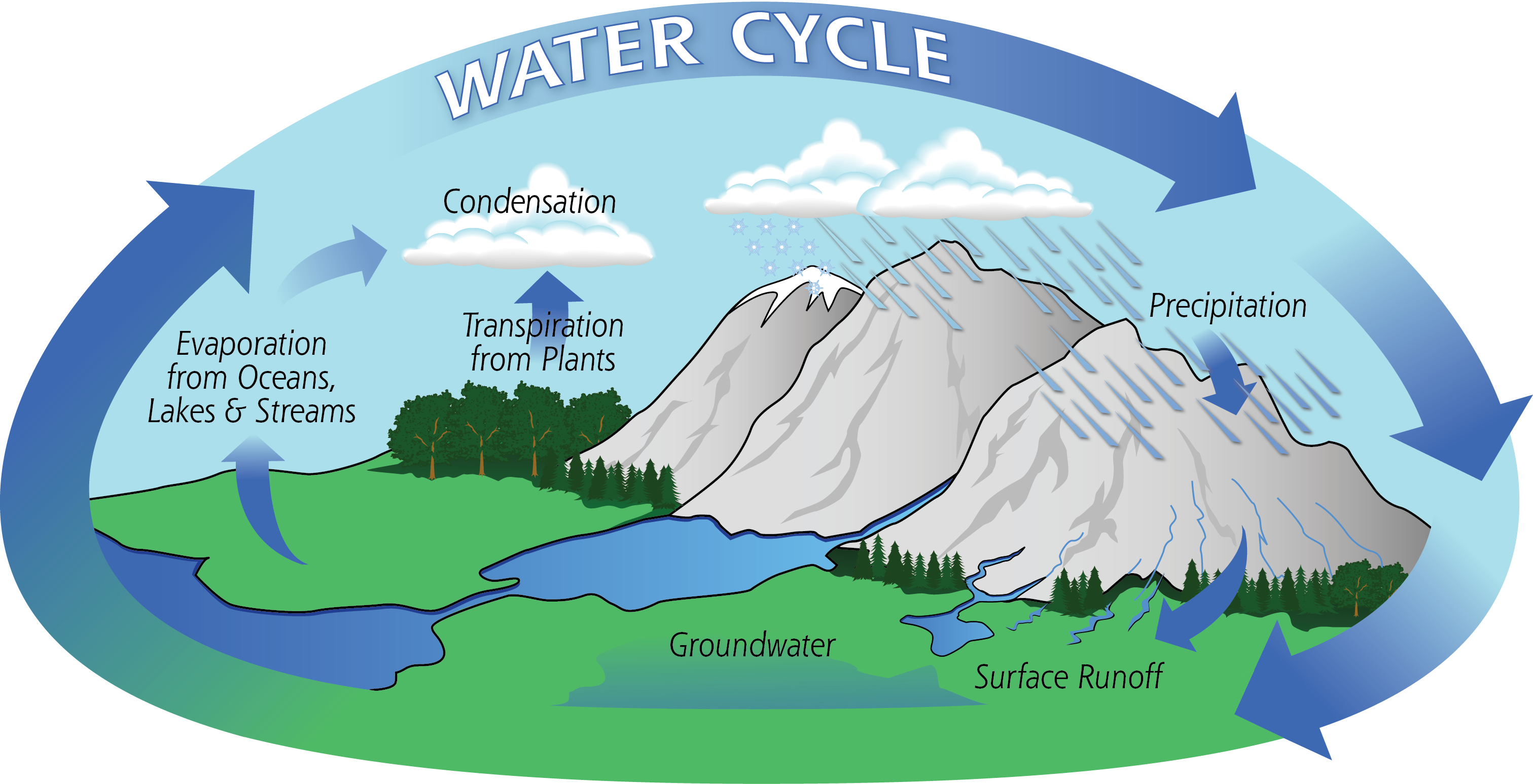
Evaporation


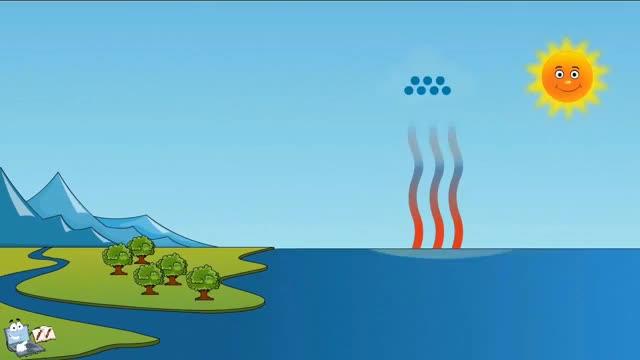
The process of water molecules escaping the surface of the Earth and entering the atmosphere is known as evaporation. Evaporation takes place as molecules of water escape from a collective body of water. This can be a puddle, a lake, a stream, or just a droplet of water. As water molecules evaporate, they take with […]

Climatic Controls


A number of factors influence the climates found around the globe. These factors are often referred to as controls. We will discuss these controls in more detail in other articles. Only a brief summary will be provided here. The first of these controls is latitude. Latitude is the angular measurement in degrees of the distance […]

Remote Sensing of The Earth


  Throughout most of history, the only tools that map makers had to help them understand and portray the shape of the Earth and its continents were the map maker’s writing implements and their own two legs. It is truly amazing how accurate maps were considering their limited technology. However, maps could vary greatly depending […]

Isolines


Isolines In Geography, it is often necessary to describe distributions on a map. Let’s consider an example that most of us are familiar with. Have you ever watched the weather report on your local nightly news? One of the important jobs of a meteorologist, or weatherman / weatherwoman, is to show their viewers the distribution […]

Map Shape Vs Map Size


Shape Versus Size – Conformality Versus Equivalency Each of the map projections previously discussed as well as any other type of map projection must consider two important factors. What is more important, depicting the accurate sizes of objects on the map, or depicting accurate shapes of these objects? The challenge is that you cannot have […]

Map Projections


Globes are the most accurate way to represent the surface of the Earth. However, because it is not practical to carry a globe into the field, map makers must figure out how to represent a round map on a flat piece of paper, or on a flat screen. Consider the challenge of gift wrapping a […]

Using Maps


Maps have been used by humans for hundreds of years. As technology has improved, so have the quality and accuracy of maps. Ancient maps were usually drawn by explorers. It was impossible at that time for anyone to leave the Earth and look down at the huge continents below. All they could do was walk […]

Maps Are Useful


Suppose we want to find a buried treasure, and the only person who knows where the treasure is cannot travel with us. How will we find the treasure? The individual who knows where the treasure is could describe to us in great detail how to get to and find the treasure. This might work, but […]