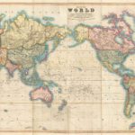
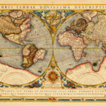
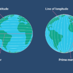
Globes are the most accurate way to represent the surface of the Earth. However, because it is not practical to carry a globe into the field, map makers must figure out how to represent a round map on a flat piece of paper, or on a flat screen.
Consider the challenge of gift wrapping a rubber bouncy ball. What happens as you place gift wrap around the ball? Can you wrap the ball in such a way so that the paper is perfectly flat? No matter how long you try, you cannot cover a round object with flat piece of paper without creating wrinkles, folds, or cuts in the paper.
Over the centuries, many different ways of representing the round Earth on flat paper have been developed. Each of these methods is referred to as a map projection. What does it mean to project something? Have you ever been to the movie theater? How does the movie get on the movie screen? The image you watch on the screen is projected using a high powered light from the back of the theater. Now, imagine placing a projector inside of a globe and projecting the different continents, islands, and other features onto a flat screen. What would the projection look like? This depends on where you place the screen.
Cylindrical Projection
A cylindrical projection map is the most common type of map that we see. Imagine placing the movie screen around the globe in a cylinder shape. The projection that results is depicted in this image. Notice that areas close to the equator have very little distortion. However, the closer to the poles that one travels, the more distorted the map becomes. In this example, Greenland appears to be many times larger than it really is.

Conic Projection
A conic projection map is created by placing a cone shaped screen on a globe. The resulting projection is more accurate than the cylindrical projection map discussed above. However, the further we travel down the map, the more distorted and less accurate the map becomes.

Plane Projection
A plane projection is created by placing an imaginary screen directly above or below a globe. The image that would result is called a plane projection. This type of map projection is not commonly used.

Interrupted Projection
There are many different types of interrupted projection maps. These types of maps try to depict the continents as accurately as possible by leaving blank space in the less important areas of the map, such as in the oceans.


