Once rocks have been broken down by weathering and by mass wasting, the final fate of all materials is to be carried away to another location by erosion.
The most influential force in erosion is water. Water’s ability to move materials from one location to another, along with the fact that it is found everywhere along the surface of the earth, make it a superb tool for erosion.
Valleys And Interfluves
All terrain can be classified in one of two groups. These groups are valleys and interfluves. Valleys are areas of lower terrain, while interfluves are areas of high terrain located between valleys.
Often the difference between valleys and interfluves is obvious. This is especially the case where high mountains surround a low valley. In other cases, the difference is difficult to detect. The interfluve may be just a few feet higher than the valley floor.
Why are valleys and interfluves important? Water always flows from high terrain downward, towards lower terrain. Thus, water is not found in abundance in interfluves, while it gathers in the form of streams and lakes in valleys.
Drainage Basin / Watershed
The precipitation that falls into a valley, and on surrounding interfluves flows downward usually creating a stream or river. The area of land that contributes water to a stream or river is called a watershed, or drainage basin. Small drainage basins generally contribute to streams, while the water from larger drainage basins come together to form large rivers.
Often, small drainage basins or watersheds combine with one another, creating larger and larger networks of drainage basins. All of these combined drainage basins are together referred to simply as a drainage basin, or as one watershed.
The area between two drainage basins is known as a drainage divide. In North America a massive drainage divide known as the Continental Divide separates the water that flows towards the Pacific Ocean, with water that drains towards the Gulf of Mexico, and towards the Atlantic Ocean.
Erosion By Overland Flow
Between valley’s at the top of interfluves water runs across the landscape in flat sheets known as overland flow. As rain drops begin falling in a rain storm they are first absorbed by the landscape. As the ground becomes saturated, the drops begin moving across the landscape above the surface. As this happens, small amounts of dust and dirt are carried with the water. This is known as splash erosion. As more and more water falls, the sheet of moving water becomes larger and larger.
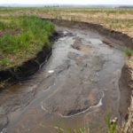
Eventually the water forms rills. Rills are small channels of water running across the surface of the landscape. The creation of rills happens much more quickly in areas where there is little vegetation. Plant roots help to hold dirt and rocks in place, retarding the formation of rills.
Eventually, many rills come together, forming larger gullies. Gullies can get quite large, and help to feed large amounts of water into streams and rivers.
Erosion By Stream Flow
As water enters the floor of a valley, it typically is dumped into a river or stream. Rivers and streams are moving bodies of draining water, that have a tremendous amount of force. Because of their strength, streams and rivers can cause a great amount of erosion.
Dirt and dust is carried away in the water of the river, leaving only pebbles and rocks. The rocks are constantly smacking into one another, as the force of the river moves them about. This causes them to be continually breaking into smaller and smaller pieces.
Rivers have been known to carve deep canyons in the bedrock in only a few hundred thousand years.
Deposits
As rivers carry dust, pebbles, and rocks downstream, this material is eventually deposited at some location further down. These deposits form at bends in a river, as well as in locations where rivers dump water into lakes, seas, and oceans.
The effect of deposits is that new land is created using materials from other locations upstream.
Floodplains
Floodplains form alongside shallow meandering rivers. As the rivers move back and forth across the landscape they form an area around the river where the elevation of the land is lower than other areas. This lower land around the river is known as a floodplain. During times of excess precipitation, water leaves the banks of the river, but remains confined to the floodplain.


