Throughout most of history, the only tools that map makers had to help them understand and portray the shape of the Earth and its continents were the map maker’s writing implements and their own two legs. It is truly amazing how accurate maps were considering their limited technology. However, maps could vary greatly depending on who created them. Which map makers map was more accurate? It was impossible to know.
In recent decades, technologies have improved dramatically. These technologies allow cartographers, or map makers, to use remote sensing to measure the Earth and create precise maps.
Remote sensing is any technology that can be used to create maps without having to physically touch the territory being described. These remote sensing technologies are often deployed from a plane or satellite.
Aerial Photographs
Aerial photographs were the first type of remote sensing utilized by cartographers, or map makers. In 1858, French map makers used a hot air balloon and primitive cameras to take the first aerial photographs. Later during World War I, airplanes were used to systematically take aerial images of much of the terrain in the war zone.
By comparing photographs taken at different angles, cartographers can create accurate and detailed maps of different territories. The process of comparing different aerial photographs and determining accurate measurements is called photogrammetry. Maps created by using aerial photographs are called orthophoto maps.
Infrared Sensing
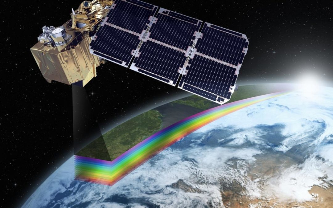
As illustrated by this diagram, the human eye can only see a small portion of the light or electromagnetic spectrum. The colors we see are those that we commonly associate with a rainbow. As the wavelength of the electromagnetic spectrum becomes too high or too low, it becomes invisible to the human eye.
Infrared sensing provides many advantages over aerial photography. Using infrared sensing, cartographers can detect the temperatures of different objects on the ground. This can help when mapping living objects, such as plant and animal distribution. Living organisms generate heat, while dead objects generally do not. For this reason, infrared sensing is commonly used when studying crops, and the health of different habitats.
Microwave Sensing
Microwaves can be used for more than just cooking meals. A microwave is an electromagnetic wave with a very long wave length. By scanning the Earth using microwaves, geographers get a unique type of map. Because of the long wave length, these types of maps are generally not very detailed. However, they are very useful in depicting the characteristics that exist beneath the surface of the Earth.
Radar Sensing
Using radar, geographers can effectively map out the terrain of a territory. Radar works by sending out radio signals, and then waiting for them to bounce off the ground and return. By measuring the amount of time it takes for the signals to return, it is possible to create a very accurate topographic map. An important advantage to using radar is that it can penetrate thick clouds and moisture. This allows scientists to accurately map areas such as rain forests that are otherwise too obscured by clouds and rain.
Sonar Sensing
Sonar works in a similar manner as radar. However, instead of sending out radio waves, researchers send out sound waves. By measuring the time it takes for these sound waves to travel towards an object, bounce off of it, and then return, it is possible to calculate distances. Sonar sensing is used in water. This allows scientists to accurately map the two thirds of the Earth that is under water. One common use of sonar sensing is in fishing boats. By using sonar, a small onboard computer calculates the depth of a lake, and also the location of nearby fish.
Sonar Map


